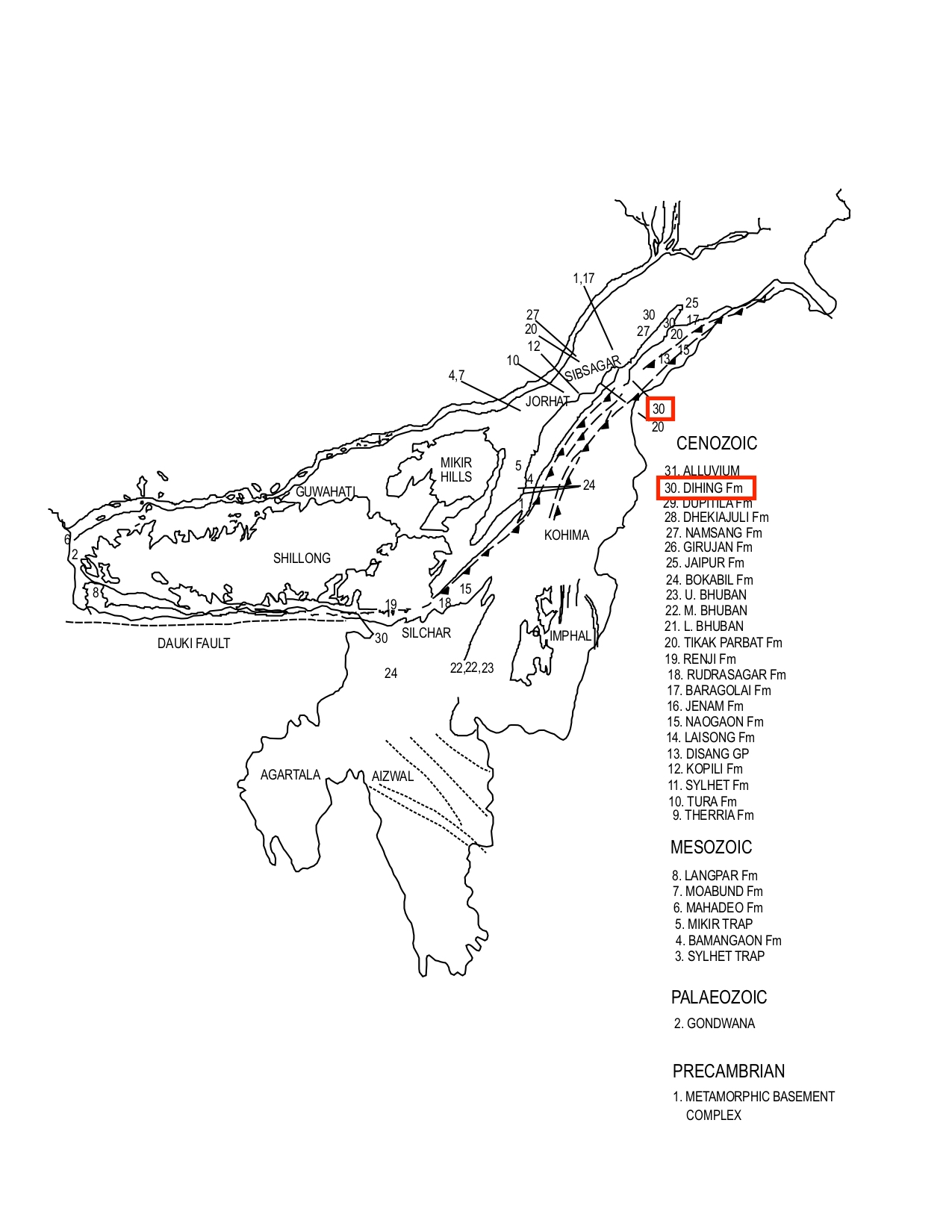
Dihing Fm
Type Locality and Naming
FR Mallet gave this name after the Dihing River (17°16'N; 90°24'E), near Jaipur in Assam. [Original Publication: Mallet, F.R. (1876). On the coal fields of Naga Hills bordering the Lakhimpur and Sibsagar districts, Memoir of Geological Survey of India (1292), pp: 14-94]. Reference section: Mana Basum Range.
Synonyms: The pebble beds unconformably overlying Tipam Gr Series and overlain by alluvium were classified as Dihing Series.
[Figure 1: Geological set up and formation stratotypes of North East Basins (modified after Pandey and Dave, 1998)]
Lithology and Thickness
Clayey sandstone. Alternations of yellow and grey, medium-grained, clayey sandstone with occasional sandy clay beds and with pebble beds on top. Near the base in the reference section, it consists of soft greenish, argillaceous sandstones with occasional sandy clay beds. Towards the top, it contains alternations of thick pebble beds and soft, clayey sand. At places the unit is reported to contain white clay at the base [Sifatul Quader Chowdhury, Mujibur Rahman Khan and Md Nehal Uddin]. The thickness of 24 m as observed in the Ramu area in Cox's Bazar district of Bangladesh does not match the thickness in Assam, where it ranges from 305 m in the type section to 1,525 m in the Mana Bum environs. In the northeastern part of Schuppen Belt the thickness varies between 300 to 1600 m.
Relationships and Distribution
Lower contact
The Dihing Formation unconformably overlies the Dupitila Fm.
Upper contact
The formation is unconformably overlain by the older portion of the alluvial cover (called NEBasinAlluvium Fm here for linking purposes). In SE Bangladesh in Rajshahi, Dinajpur and Bogra districts, depending upon usage, it underlies conformably a Barind Clay Fm of up to 50 m of yellowish brown to reddish brown clay, silty-clay and silty-sand with minor sand.
Regional extent
In the Tripura-Cachar Fold Belt the thickness is of the order of 500 to 1000 m. The Dihing Fm is exposed in the Schuppen Belt, Tripura-Cachar Fold Belt, Mikir Hills and in West Khasi and Garo Hills. The formation has a patchy distribution within Bangladesh.
GeoJSON
Fossils
No record on paleontological studies.
Age
Depositional setting
Additional Information
Banglapedia (National Encyclopedia of Bangladesh as compiled by several geologists; http://en.banglapedia.org/index.php/Geological_Group-Formation; 2015)
